Mount Rinjani National Park
A schools guide to Mount Rinjani National Park, Lombok. Permits, wildlife, volcanic activity and everything your school needs to know.
Enquire NowThis guide is written for teachers and school administrators who want to understand Mount Rinjani National Park before planning a school expedition to Lombok. It covers what the park is, how it is managed, what permits are required, what wildlife students will encounter, and the geological significance of the mountain — including its volcanic history and active status. If you are assessing whether Mount Rinjani is an appropriate and safe environment for a school group, this page gives you the authoritative background you need.
Mount Rinjani National Park
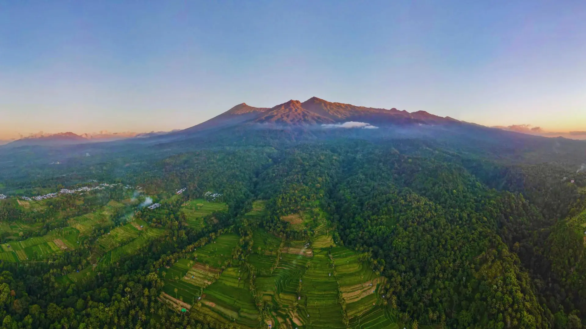
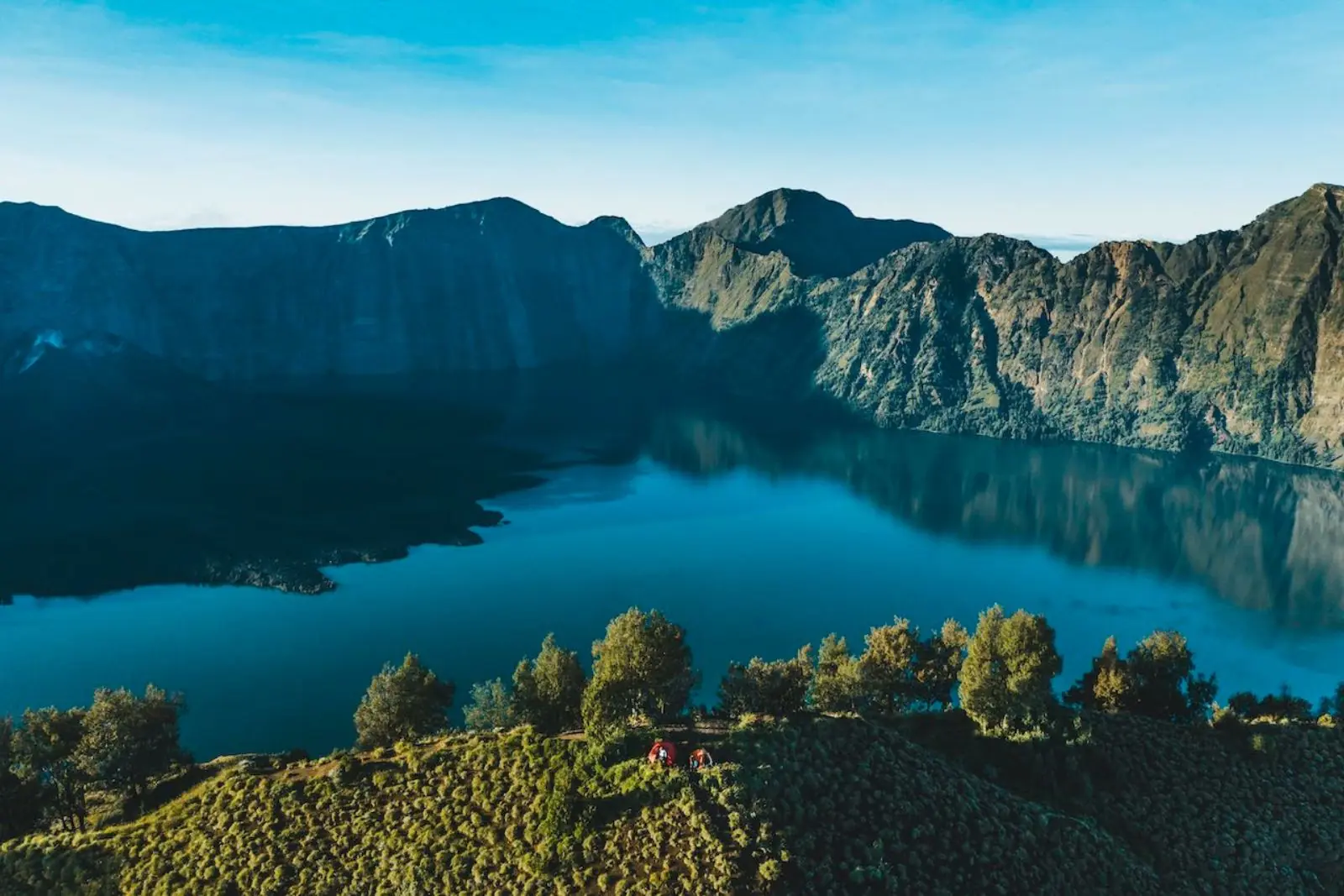
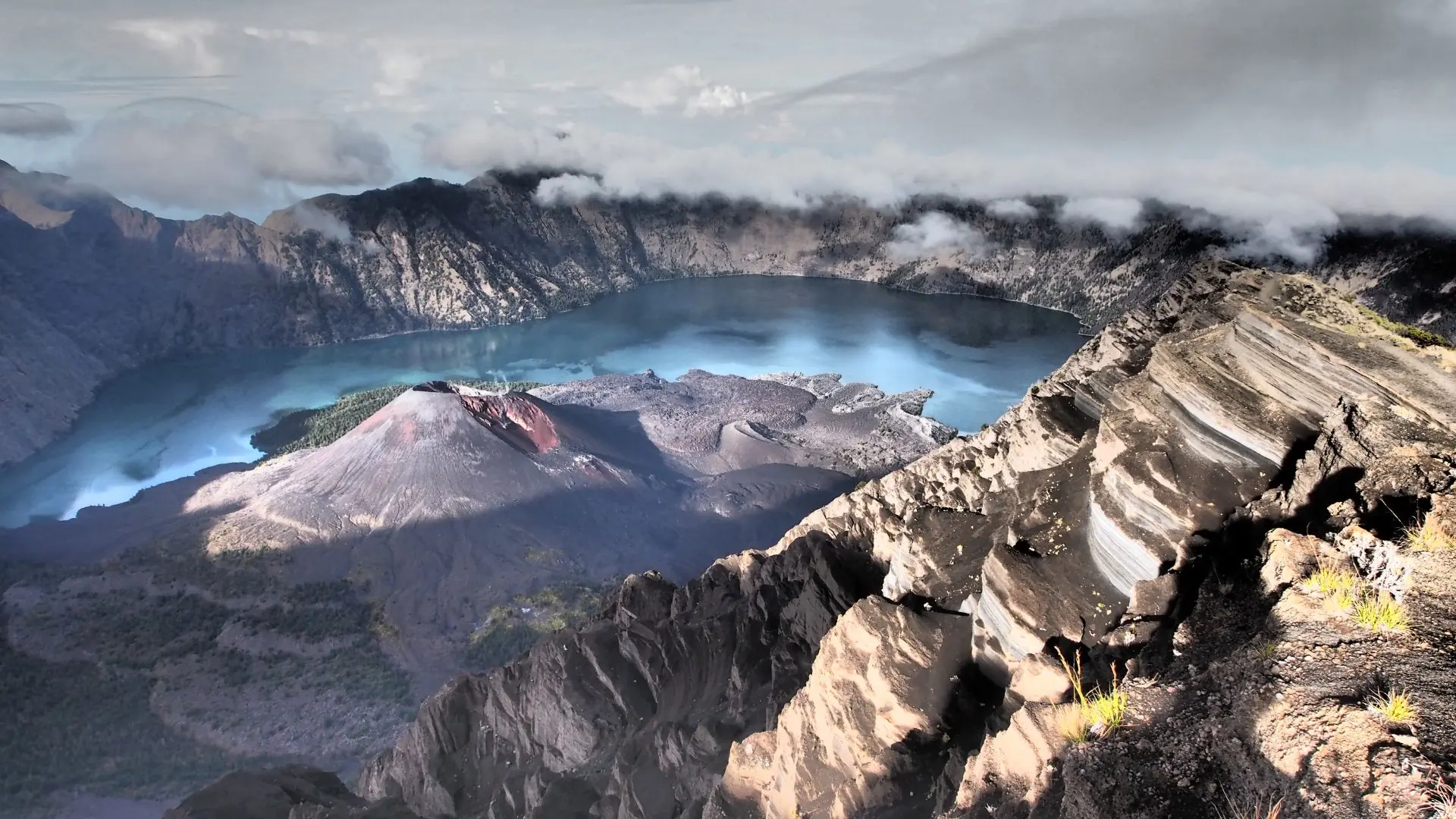
Mount Rinjani National Park is a protected volcanic national park covering 41,330 hectares in the north of Lombok Island, Indonesia. Established in 1997, the park is home to Mount Rinjani, Indonesia’s second highest volcano at 3,726 metres, the Segara Anak crater lake at 2,010 metres, and the active volcanic cone Gunung Barujari. The park is internationally recognised as part of the Rinjani-Lombok UNESCO Global Geopark, acknowledging its outstanding geological, ecological, and cultural significance.
The park sits within one of the most geologically significant volcanic landscapes in the world. In 1257 AD, the eruption of Mount Samalas — the predecessor volcano whose catastrophic collapse formed the present-day Rinjani caldera and Segara Anak crater lake — is believed to have been one of the largest volcanic eruptions in recorded human history, with global climate effects documented as far away as Greenland and Antarctica. The volcano remains active today, with significant eruptions recorded in 1994, 2009, 2010, 2015, and 2018.
For school groups, Mount Rinjani National Park provides the setting for all Venture Beyond expedition programs, from the accessible Sembalun Highlands trek to the full crater rim and summit routes. The park’s combination of volcanic geology, endemic wildlife, montane forest, and Sasak cultural heritage offers exceptional cross-curricular learning opportunities that extend well beyond the physical challenge of the climb.
The National Park at a Glance
- Established
- 1997
- Area
- 41,330 hectares
- Highest Point
- Mount Rinjani, 3,726m
- Crater Lake
- Segara Anak, 2,010m
- Lake Area
- 11 km²
- Lake Depth
- Up to 230m
- Active Volcano
- Gunung Barujari
- UNESCO Status
- Global Geopark
- Park Opens
- 1 April annually
- Park Closes
- 1 January annually
- Trekking Routes
- Senaru and Sembalun
- Permit Required
- Yes - arranged by Venture Beyond
Why Schools Choose Rinjani
Mount Rinjani National Park is the reason schools choose Lombok. The park provides a structured, permit-regulated trekking environment that is significantly safer and better managed than unregulated mountain destinations elsewhere in Southeast Asia. The daily trekker quota system limits the number of groups on the mountain at any one time, reducing trail congestion and ensuring a more authentic wilderness experience for students.
Venture Beyond Expeditions offers three tiered programs within the national park, each designed to match different levels of student fitness, experience, and school ambition:
Sembalun Highlands Program — an accessible introduction to multi-day trekking in a high-altitude national park environment, operating in the Sembalun valley and lower mountain zones without reaching the crater rim.
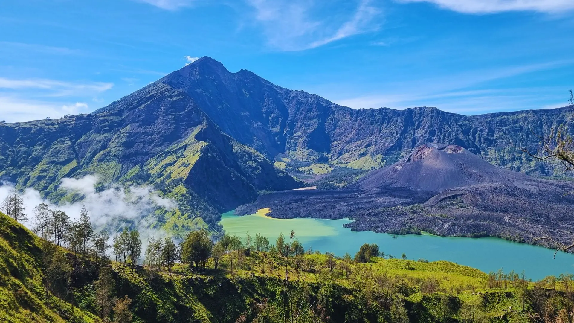
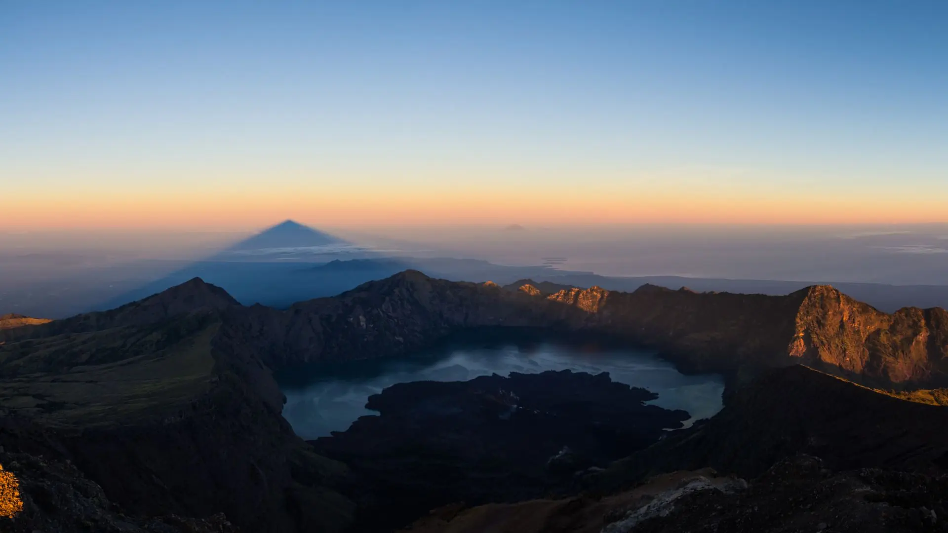
Rinjani Crater Rim Expedition — a challenging multi-day trek reaching the crater rim at 2,659 metres, with direct views into the caldera and across Segara Anak crater lake. This is the most popular program for school groups and represents a significant but achievable physical and mental challenge for students.
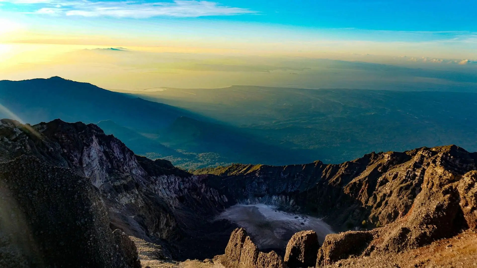
Mount Rinjani Summit Expedition — the full summit at 3,726 metres. One of the most demanding school expedition programs available in Southeast Asia, requiring strong fitness preparation and appropriate risk management. Suitable for experienced older students with teacher and parental support.
All programs operate under RTMB-licensed guides through our on-ground partner Rinjani Dawn Adventures, in full compliance with national park regulations. For more detail on each program, visit our Climbing Mount Rinjani guide.
Getting to Rinjani
Access to Mount Rinjani National Park is via two gateway villages — Senaru on the northern slope and Sembalun on the eastern slope. Both villages serve as trailheads for their respective routes into the national park and provide accommodation, permit processing, and guide services for trekking groups.
From Lombok International Airport (LOP), Senaru is approximately 90 minutes by private vehicle travelling north. Sembalun is approximately 2 hours from the airport, travelling east via the coastal road and then inland through the Sembalun valley. All transfers for Venture Beyond school groups are arranged by our ground team and included in the expedition package.
Within the national park itself, all movement is on foot. There are no vehicle tracks, cable cars, or mechanised transport of any kind above the trailheads. Porters carry all group equipment, food, and camping supplies — students carry only their personal daypack. This is standard practice on Rinjani and is arranged by Venture Beyond as part of every expedition.
For schools combining the national park expedition with time in Senaru village or the Gili Islands, all inter-destination transfers are managed by Venture Beyond. Schools do not need to arrange any independent transport at any point during the program.
Mount Rinjani Geology
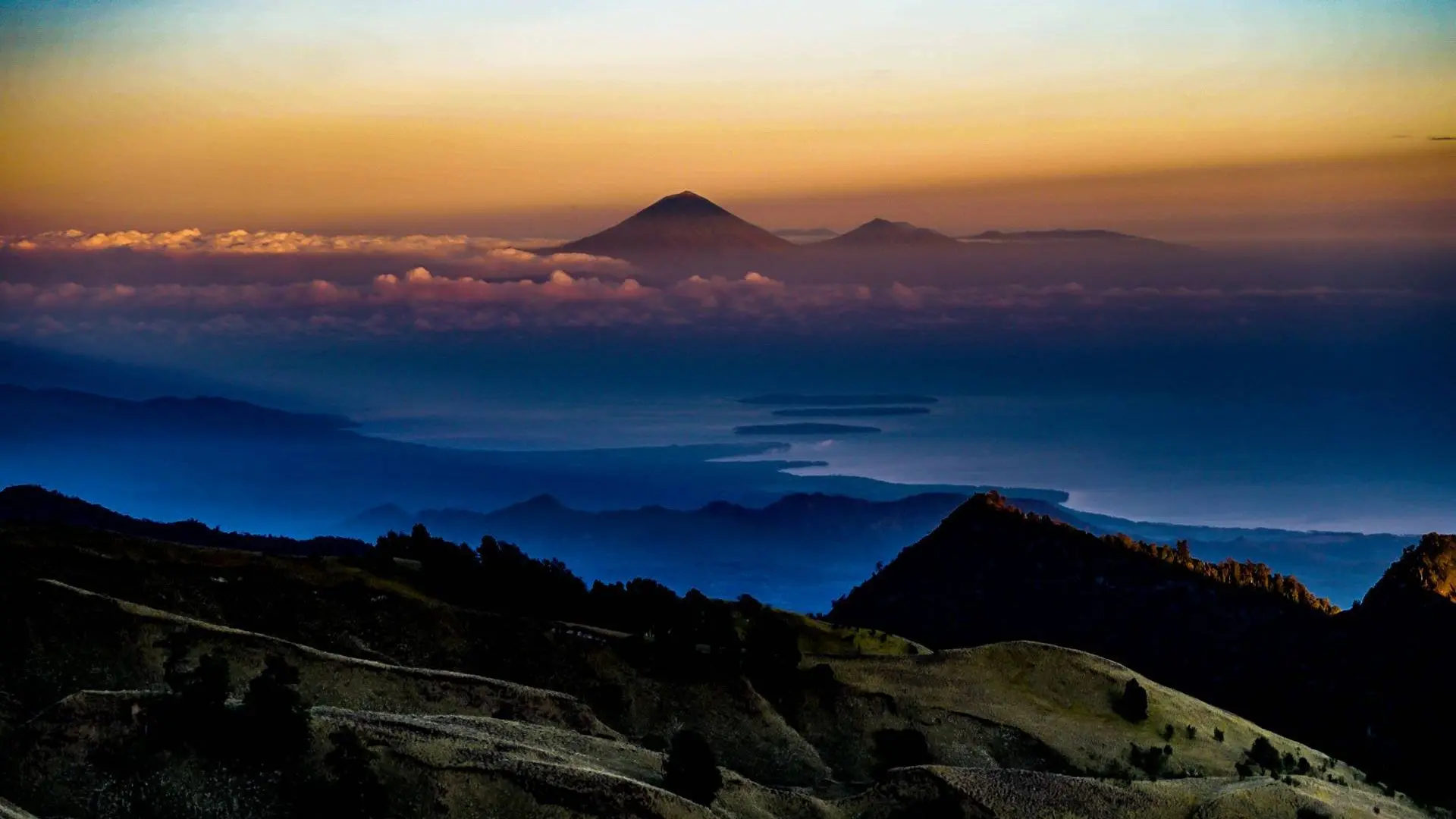
Mount Rinjani sits within one of the most geologically significant volcanic landscapes in Southeast Asia. The mountain is a stratovolcano — a composite cone built up over thousands of years of successive eruptions — and forms part of the volcanic arc created by the subduction of the Australian tectonic plate beneath the Eurasian plate. This process continues today, making the region one of the most tectonically active on earth.
The present-day Rinjani caldera was formed by the catastrophic collapse of Mount Samalas following its eruption in 1257 AD. Ice core records from Greenland and Antarctica, as well as tree ring data from across the northern hemisphere, have confirmed this as one of the largest and most climatically significant volcanic eruptions in recorded human history. The eruption ejected an estimated 40 cubic kilometres of material and caused a volcanic winter that contributed to crop failures and famine across Europe and Asia in the years that followed.
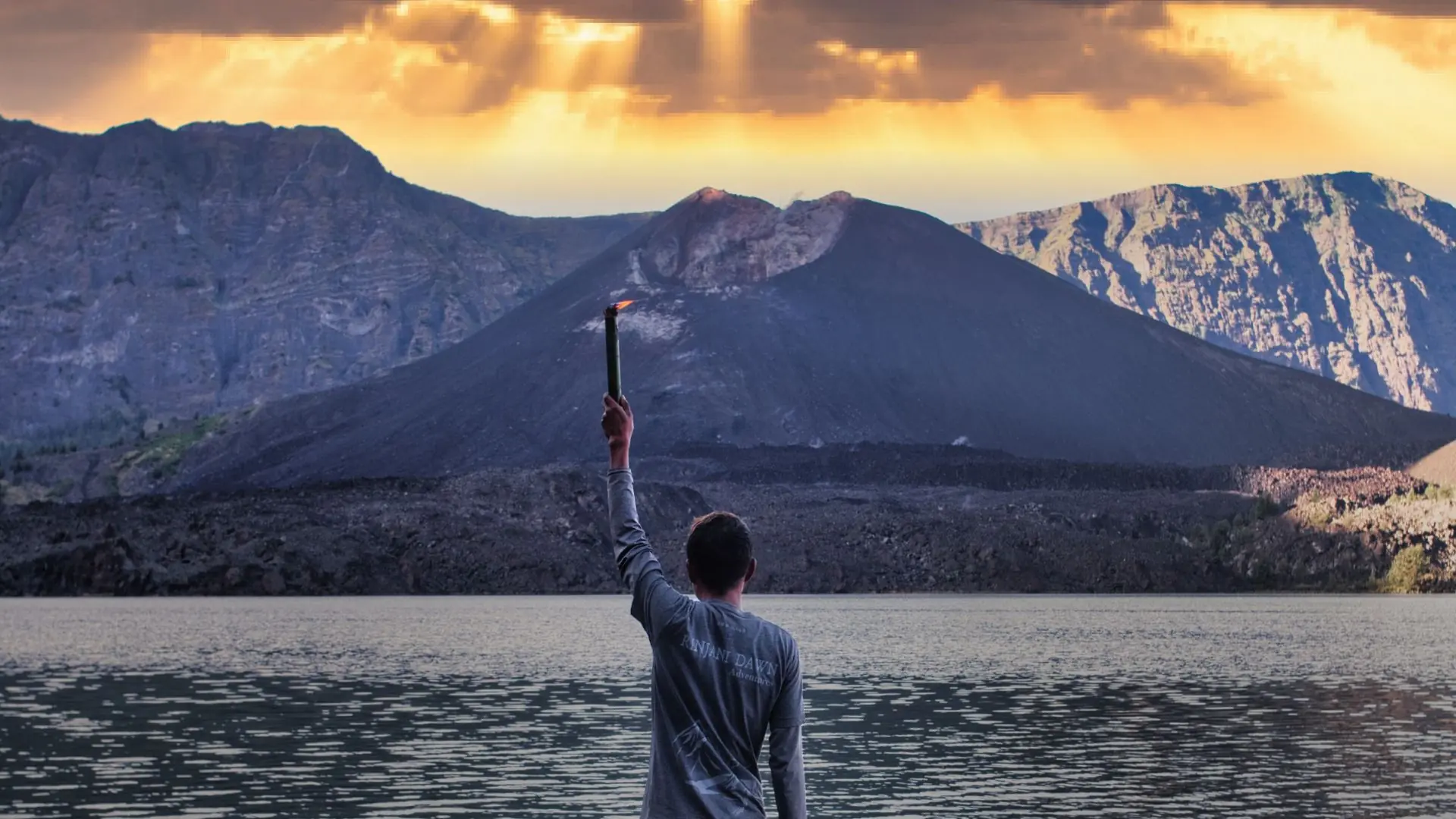
The caldera subsequently filled with water to form Segara Anak crater lake, which sits at 2,010 metres and covers approximately 11 square kilometres with depths of up to 230 metres. Rising from the lake’s surface is Gunung Barujari, a new volcanic cone that has been growing within the caldera since at least the 19th century and remains the primary source of ongoing volcanic activity. Significant eruptions from Gunung Barujari were recorded in 1994, 2009, 2010, 2015, and 2018.
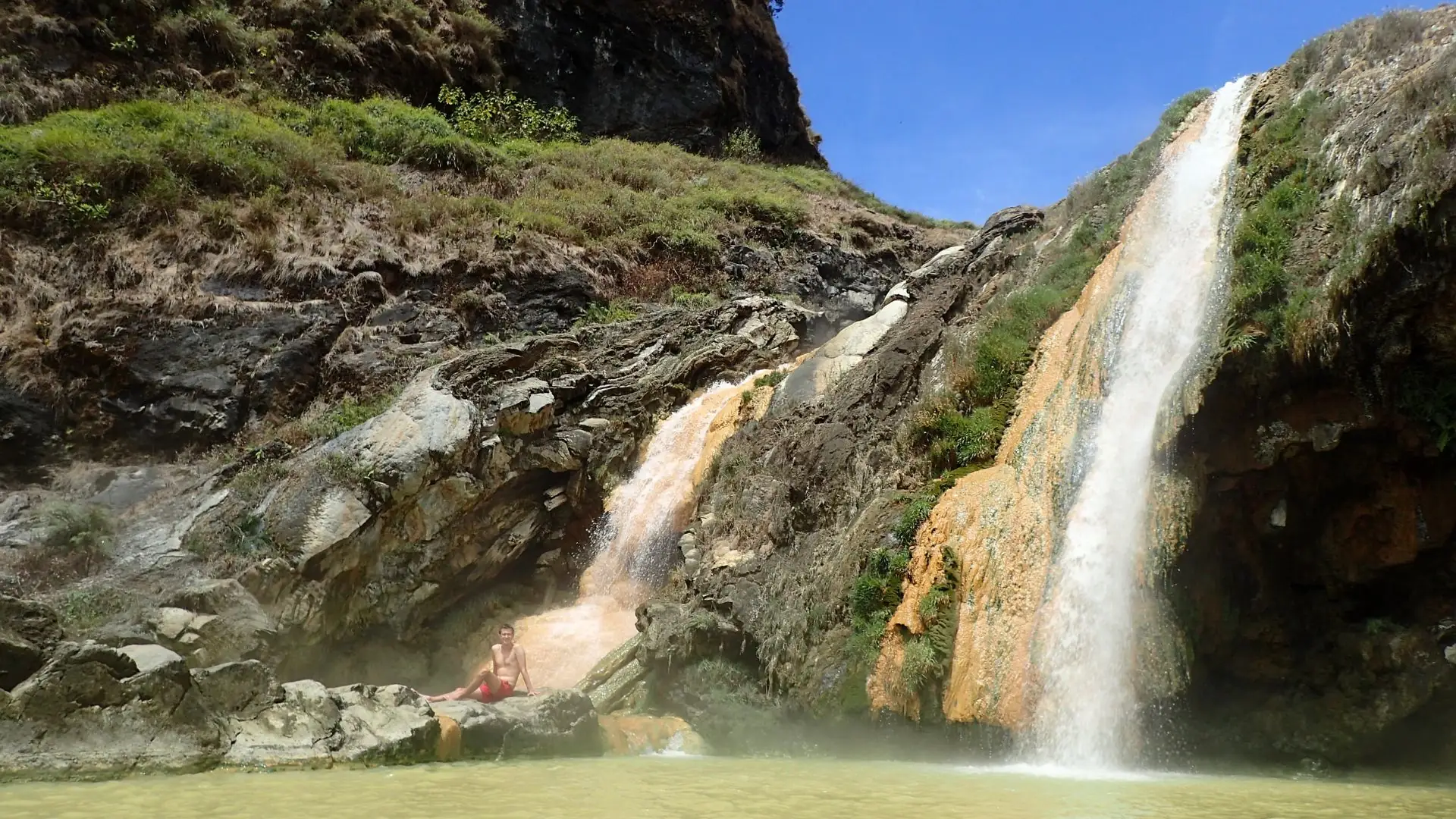
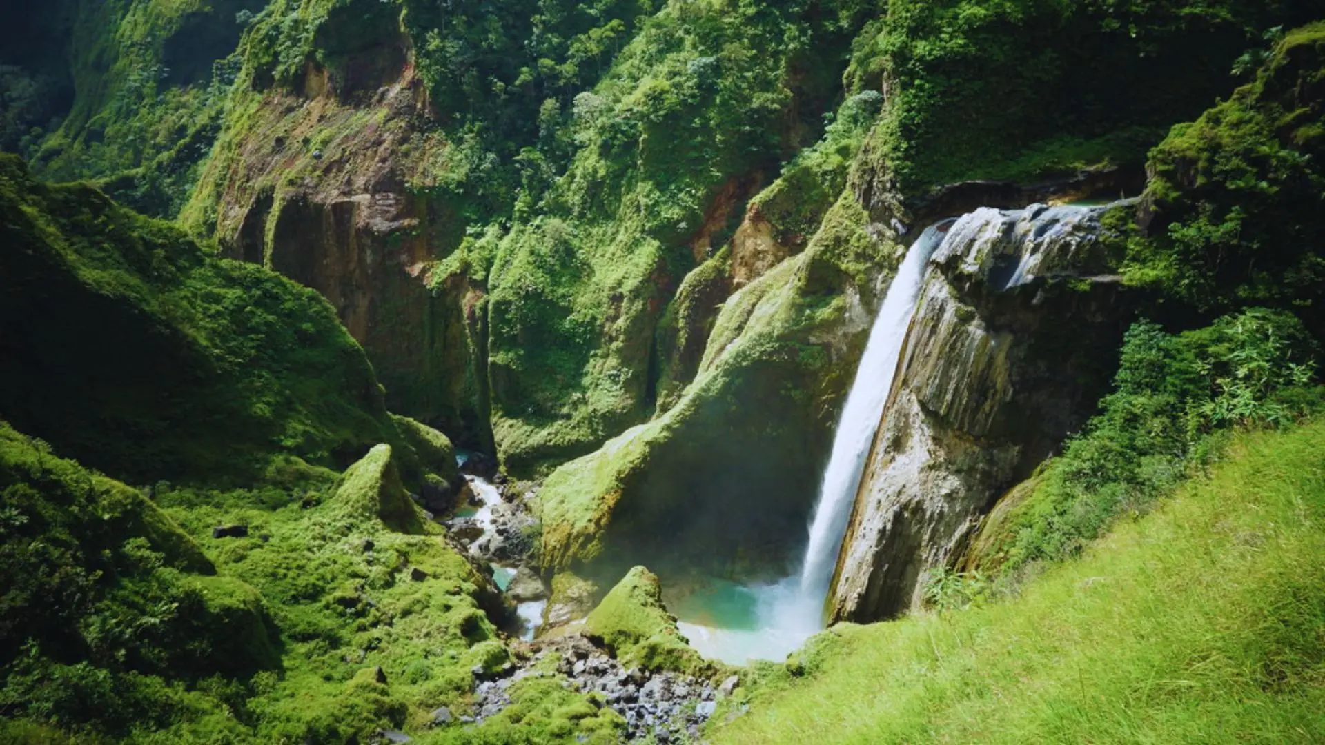
For school groups, the geological narrative of Mount Rinjani offers exceptional cross-curricular learning opportunities across earth sciences, geography, and history. Students trek through multiple volcanic rock formations, observe hydrothermal activity at the crater lake hot springs, and gain direct experience of a living volcanic system — an educational encounter that cannot be replicated in a classroom.
The broader volcanic and geological significance of the region is recognised through its designation as the Rinjani-Lombok UNESCO Global Geopark, which encompasses the national park and surrounding landscape as an area of outstanding international geological heritage.
Mount Rinjani National Park
Frequently Asked Questions
What is Mount Rinjani National Park?
Mount Rinjani National Park is a protected area in the north of Lombok Island, covering approximately 41,330 hectares of volcanic mountain terrain, tropical forest, and crater lake. It was established as a national park in 1997 and is home to Mount Rinjani, Indonesia’s second highest volcano at 3,726 metres. The park sits within one of the most geologically significant volcanic landscapes in the world. In 1257 AD, the eruption of Mount Samalas, the predecessor volcano whose collapse formed the present-day Rinjani caldera and Segara Anak crater lake, is believed to have been one of the largest volcanic eruptions in recorded human history, with global climate effects documented as far away as Greenland and Antarctica. The park is internationally recognised as part of the Rinjani-Lombok UNESCO Global Geopark, acknowledging its outstanding geological, ecological, and cultural significance.
How big is Mount Rinjani National Park?
The national park covers 41,330 hectares, making it one of the largest protected areas in the Lesser Sunda Islands. The park encompasses the entire upper mountain zone above approximately 1,000 metres, including the summit at 3,726 metres, the crater rim, Segara Anak crater lake at 2,010 metres, and the surrounding montane and submontane forest zones. For school groups climbing Mount Rinjani, the trekking routes pass through multiple ecological zones within the park, from the lower forest trails to the high-altitude volcanic terrain near the summit.
Is Mount Rinjani National Park open all year?
No. The national park operates a seasonal closure for safety reasons. The park closes on 1 January each year and reopens on 1 April. This closure coincides with the wet season, during which heavy rainfall makes the upper trails dangerous and the summit routes impassable. Schools planning expeditions must target the April to November dry season window. Venture Beyond Expeditions confirms current park status and route conditions at the time of booking and will advise schools if any closures or restrictions are in place.
What wildlife lives in Mount Rinjani National Park?
The national park supports a diverse range of endemic and protected wildlife across its forest and montane zones. Notable species include the Rinjani scops owl, endemic to the mountain and found nowhere else on earth, the subak or Javan lutung (a black leaf monkey), wild boar, and a variety of reptiles and amphibians. The park also supports over 100 bird species. Students on Venture Beyond expeditions pass through the lower forest zones where wildlife sightings, particularly birds and monkeys, are common. The ecological diversity of the park adds a valuable natural science dimension to the expedition experience.
What trekking permits are required for Mount Rinjani National Park?
All trekkers entering Mount Rinjani National Park are required to hold a valid national park entry permit. Permits are issued by the Rinjani Trek Management Board (RTMB) and are mandatory for all routes, including the Senaru and Sembalun approaches. There is a daily quota system in place to manage the number of trekkers on the mountain at any one time. For school groups, all permits are arranged by Venture Beyond Expeditions as part of the expedition package. Schools do not need to arrange permits independently.
How is the National Park managed and regulated?
Mount Rinjani National Park is managed by the Indonesian Ministry of Environment and Forestry through the Balai Taman Nasional Gunung Rinjani (BTNGR), the national park authority. Day-to-day trekking operations are coordinated through the Rinjani Trek Management Board, a collaborative body involving the national park authority, local government, and licensed trekking operators. All guides operating within the park must be licensed by the RTMB. Venture Beyond Expeditions works exclusively with RTMB-licensed guides through our on-ground partner Rinjani Dawn Adventures, ensuring full compliance with national park regulations.
What conservation efforts are in place in the National Park?
Mount Rinjani National Park is subject to ongoing conservation programs covering reforestation, wildlife protection, and sustainable trekking management. The daily trekker quota system is a direct conservation measure designed to reduce trail erosion and protect the fragile high-altitude ecosystem. The Rinjani-Lombok UNESCO Global Geopark designation supports broader conservation and geotourism initiatives across the region. Venture Beyond Expeditions adheres to a strict leave-no-trace policy on all expeditions and participates in local trail maintenance initiatives through Rinjani Dawn Adventures.
Is Mount Rinjani National Park suitable for school groups?
Yes. Mount Rinjani National Park is one of the most well-suited national park environments in Southeast Asia for school expedition programs. The trekking infrastructure is established, the permit and quota system provides structured access, and the combination of volcanic geology, endemic wildlife, and indigenous Sasak culture offers rich cross-curricular learning opportunities. Venture Beyond Expeditions offers three tiered expedition programs within the national park, from the accessible Sembalun Highlands program to the full Mount Rinjani Summit Expedition at 3,726 metres. All programs are designed specifically for school groups and comply fully with national park regulations.
Is Mount Rinjani volcanically active?
Yes. Mount Rinjani is an active volcano and should be understood as such by all schools planning an expedition. The volcano has erupted multiple times in recent decades. Significant eruptions occurred in 1994, 2009, 2010, 2015, and most recently in 2018, when a series of eruptions and associated earthquakes caused trail closures and temporary evacuations on the mountain. A new volcanic cone, Gunung Barujari, sits within the Segara Anak crater lake and is the primary source of ongoing volcanic activity.
Volcanic activity is closely monitored by the Indonesian Centre for Volcanology and Geological Hazard Mitigation (PVMBG), which issues alert levels from 1 (normal) to 4 (danger). Trekking within the national park is only permitted when the alert level is at 1 or 2. Venture Beyond Expeditions monitors volcanic activity continuously and will not operate expeditions when alert levels are elevated. Schools are briefed on volcanic risk as part of the pre-expedition risk management process.
What is Segara Anak crater lake?
Segara Anak is a crater lake sitting at 2,010 metres within the caldera of Mount Rinjani, formed by the catastrophic collapse of Mount Samalas following the 1257 AD eruption. The name means “Child of the Sea” in the Sasak language, reflecting the lake’s striking turquoise blue colour. Segara Anak covers approximately 11 square kilometres and reaches depths of up to 230 metres, making it one of the largest and deepest crater lakes in Indonesia.
The active volcanic cone Gunung Barujari rises from the lake’s surface, and hot springs feed into the lake’s eastern shore, a popular rest stop for trekking groups. For school groups on the Rinjani Crater Rim Expedition, Segara Anak is visible from the crater rim at 2,659 metres and provides one of the most dramatic and memorable moments of the expedition. The lake also holds deep spiritual significance for the Sasak and Balinese Hindu communities, who make pilgrimages to its shores for ceremonial bathing and offerings.
Start Planning Your Expedition
Ready to take the next step? Complete the form below and a member of the Venture Beyond team will be in touch within 24 hours.